
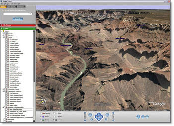
Here are some sample photos -- courtesy of Google Images -- from my latest toy, which I downloaded for free and spent about two hours with this weekend: Google Earth. Consisting of satellite photos that have been blended together into a composite 3-d photo of the Earth, you can fly anywhere within seconds -- even tip the world on its axis and glide over its surface as if in an airplane. This program is still in its early generations, but is already amazingly sophisticated. You can type your address into the "Fly To" window, free fall through space and within seconds be hovering over it at about 1,000 feet. Some places -- like the Eiffel Tower above or the Grand Canyon below, are really well photographed, and you can hover over them at 900 feet and see the view below at a pretty nearly perfect resolution. Other places -- in the midst of Africa, Siberia, Antarctica -- get blurry below about 20 or 30,000 feet. (Apparently an enhanced version, for which you pay about $20 a year, is better...) I can imagine in a few years we'll be taking virtual tours through cities, with scenes recorded in real time. Apparently the military doesn't like this, for obvious security reasons. But one thing I like about this program is that it reinforces the notion of the world as one ball in space -- and rather small one, at that. So we'd better take care...
Next time you look up into the sky, smile: a satellite may be taking your photo!
No comments:
Post a Comment